Why Use Thermal Imaging Cameras for Forest Fire Prevention?
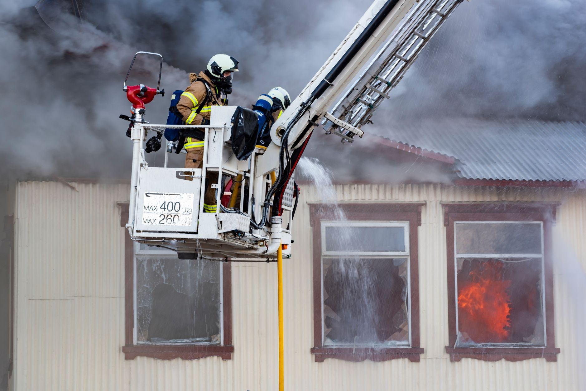
The core value of a forest fire thermal imaging camera is not to produce a visually attractive picture. It is to convert tree crowns, dry branches, ground embers, vehicle exhaust pipes, human activity, and other objects into a temperature distribution map. When there is no open flame, no visible smoke column, or visible-light illumination is close to 0 lx at night, thermal imaging can still identify abnormal heat sources through infrared radiation. That is exactly the capability early forest fire warning systems need.
What Problems Does a Forest Fire Thermal Imaging Camera Solve?
Early-stage forest fires are often not large flames. They may begin as small-area smoldering, reignition of residual embers, illegal outdoor burning, or a high-temperature point near a power transmission corridor. Conventional visible-light cameras depend on illumination and smoke contours. Nighttime scenes, backlight, haze, fog, moving tree shadows, and changing cloud cover can all reduce recognition stability.
Thermal imaging observes heat radiation instead of reflected visible light. Common long-wave infrared (LWIR) systems operate in the 8-14 μm band, while common mid-wave infrared (MWIR) systems operate in the 3-5 μm band. Because the image is built from thermal contrast, performance is much less sensitive to day-night transitions.
In fixed tower monitoring, a thermal camera is usually mounted on a pan-tilt unit for 360° patrol. Preset points scan forest edges, ridgelines, roads, cemeteries, campsites, power corridors, and other high-risk areas. In engineering practice, alarms usually combine several conditions: regional maximum temperature, temperature difference from background, confirmation across consecutive frames, and visible-light verification. This prevents sunlight reflections, hot vehicles, or sun-heated exposed rocks from being directly classified as fire points.
For system-level fire detection requirements, ISO/FDIS 7240-33 is a useful reference because it addresses thermal imaging fire detectors, including requirements, test methods, and performance criteria. Although forest deployments have different environmental conditions from building fire alarm systems, the trend is clear: thermal imaging is moving from an auxiliary observation tool toward a more measurable fire detection method.
How Does a Forest Fire Thermal Imaging Camera Detect Early Hotspots?
A thermal imaging detector records the radiation intensity of each pixel and converts it into a grayscale or pseudo-color temperature image. For example, with a 640×512 detector, 12 μm pixel pitch, and 50 mm lens, the instantaneous field of view of a single pixel is approximately 0.24 mrad. At a distance of 3 km, one pixel corresponds to about 0.72 m of target size. If a longer focal length lens is used, a small distant fire point occupies more pixels, but the field of view becomes narrower, so pan-tilt patrol must compensate for coverage.
Early fire detection cannot rely only on whether a target is “hot.” In summer sunlight, forest ground surfaces may exceed 50°C. Bare rocks, metal roofs, vehicle engines, and equipment housings can also create hot spots. A more reliable algorithm compares the historical temperature of the same area, temperature difference against nearby background, hot spot area growth, shape changes, and duration.
This is why forest fire monitoring is usually designed as a process, not a single threshold. The thermal channel first identifies an abnormal heat source. The visible-light channel then checks the scene context. The platform estimates coordinates from pan-tilt angle, lens parameters, and geospatial calibration. Finally, operators or AI logic classify the alarm and decide whether dispatch is required.
Camera specification comparison should also be based on measured imaging behavior, not only brochure-level “detection distance.” The EMVA 1288 standard is widely used in machine vision to describe camera and sensor measurement methods, and it is a useful reminder for procurement teams: parameters must be comparable, repeatable, and tied to a defined measurement condition.
How to Choose a Forest Fire Monitoring Camera?
For fixed watchtowers, forest farm checkpoints, and protected-area boundaries, uncooled LWIR is usually the first option. It has low power consumption, fast startup, and simpler maintenance. A module such as SPECTRA L06 640×512 LWIR 12μm is suitable for mid-range and near-range area coverage. When the project needs more image detail and higher pixel coverage, SPECTRA L12 1280×1024 LWIR can provide a wider resolution margin for large scenes and distant targets.
For long-range observation, key ridgelines, or high-value forest assets, cooled MWIR can be evaluated. MWIR has advantages for high-temperature targets, long-distance detection, and narrow-field optical systems. However, it also brings higher cost, higher power consumption, and stricter maintenance requirements. It is not always the best starting point for every forestry project.
Procurement teams should not evaluate only the “maximum detection range.” They should confirm lens focal length, field of view, NETD, frame rate, temperature measurement method, enclosure protection rating, defog strategy, pan-tilt repeatability, and local calibration capability. These factors determine whether a camera can actually detect a small hot spot, keep it in view, and report it consistently under local weather and terrain conditions.
If the site requires both a thermal map and a visible-light image for evidence, a dual-band design is often better. A module such as FUSION LV0625A 640×512+2560×1440 MIPI 35mm supports the workflow of “thermal anomaly alarm plus visible-light confirmation.” This is useful when dispatch centers need to distinguish fire risk from vehicles, people, maintenance activity, or ordinary heat sources.
Network compatibility is another practical issue. Forest monitoring points may connect to existing video management platforms, command centers, or public safety networks. ONVIF Profile S is commonly referenced for IP video streaming and device interoperability, including camera and video encoder workflows. For procurement, this matters because a strong thermal camera still has to integrate cleanly with the larger monitoring system.
When Should AI Alarms and Deployment Data Be Used?
Forest fire projects are most sensitive to two problems: missed alarms and repeated false alarms. AI cannot replace thermal imaging itself, but it can automate hot spot classification, smoke-fire correlation, region masking, target tracking, and alarm grading.
For example, an edge-side system can first filter events locally, then upload only key alarms, screenshots, short clips, and coordinates. This reduces communication load, which is important for mountain sites with limited bandwidth. A single-board integrated solution such as NEXUS LV0619B AI multi-band Ethernet/SDI is well suited for this kind of edge screening and multi-band alarm workflow.
Deployment strategy should be explicit. Ordinary forest areas can start with 640×512 LWIR for broad coverage, with longer focal length lenses added for key directions. High-value or long-range monitoring points can use 1280-class LWIR or cooled MWIR. Every point should also include visible-light verification, pan-tilt presets, electronic fencing, and a manual confirmation process.
Alarm thresholds should not simply use factory defaults. At minimum, the system should collect 7-14 days of local temperature data to build a background model. This helps the algorithm understand sunrise heating, afternoon ground temperature, night cooling, seasonal vegetation changes, and repeated heat sources such as roads or buildings. The more the system understands the local thermal pattern, the easier it is to suppress false alarms without weakening early fire detection.
For projects involving transmission corridors, access roads, or mixed human activity, the camera layout should also consider operational response. A thermal alarm is valuable only if the command center can locate it, verify it, and dispatch quickly. That means every alarm should be tied to a preset position, coordinate estimate, scene image, timestamp, and confidence level. In large deployments, integration with Border Security style wide-area monitoring workflows can also be relevant because both scenarios require long-range detection, target confirmation, and centralized response.
FAQ
Q1: Can thermal imaging cameras see through heavy smoke in forest fires?
Not completely. Thermal infrared is less affected by light smoke than visible imaging, but heavy smoke, rain, fog, water vapor, and physical obstructions still attenuate the signal. Multi-point deployment and visible-light verification are still needed.
Q2: Do forest fire prevention systems always need cooled infrared cameras?
No. Most fixed forest early warning systems can start with uncooled LWIR cameras. Cooled MWIR is more suitable for ultra-long-range monitoring, critical zones, and projects with sufficient budget and maintenance capacity.
Q3: Is a thermal camera alone enough for forest fire monitoring?
No. A practical system should use a closed loop: thermal imaging detects the anomaly, visible light confirms the scene, AI grades the alarm, and operators review and dispatch.
Q4: What specifications matter most when buying a forest fire thermal imaging camera?
Start with whether the claimed detection range matches real lens focal length and pixel size. Then check resolution, NETD, protection rating, pan-tilt accuracy, algorithm false alarm rate, and local tuning capability.
Q5: How long should alarm thresholds be calibrated before operation?
A useful baseline normally requires at least 7-14 days of local temperature data. Longer calibration improves reliability when the site has strong sunlight, complex terrain, roads, buildings, or frequent human activity.